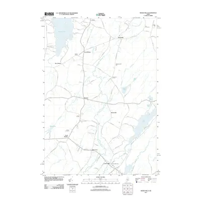
2011 Map of Weeks Mills
USGS Topo · Published 2011About this map
The West Branch Sheepscot River flows through the heart of this Kennebec County landscape, anchoring a network of historic settlements including Weeks Mills and Coopers Mills. This early 21st-century survey details the rural character of Windsor and its surroundings, where local life centers on landmarks like the Windsor Fairgrounds and the industrial legacy of the Coopers Mills Dam. The topography is marked by several family-named rises, notably Deer Hill and Windsor Neck Hill, providing a backdrop for the numerous small burial grounds that dot the area.
Find a feature on this map
108 named features on this map. Tap any name to fly to it.
Don’t see what you’re looking for? This feature index may not catch every label — zoom into the map to look around manually.
Map Details
Editions of this 2011 Weeks Mills Map
This is the sole edition of this map. No revisions or reprints were ever made.
Other maps of this area

1893 · Vassalboro
USGS Topo · 1:62,500

1893 · Wiscasset
USGS Topo · 1:62,500

1898 · Vassalboro
USGS Topo · 1:62,500

1913 · Waldoboro
USGS Topo · 1:48,000

1915 · Waldoboro
USGS Topo · 1:62,500

1916 · Liberty
USGS Topo · 1:62,500

1941 · Waldoboro
USGS Topo · 1:62,500

1941 · Vassalboro
USGS Topo · 1:62,500

1942 · Liberty
USGS Topo · 1:62,500

1943 · Vassalboro
USGS Topo · 1:62,500