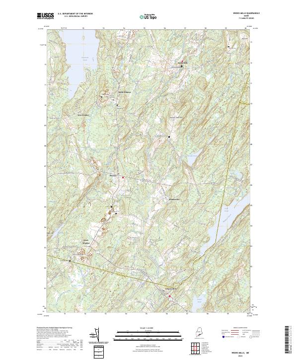
2024 Map of Weeks Mills
USGS Topo · Published 2024About this map
The West Branch Sheepscot River flows through a landscape of clustered hamlets and family-named cemeteries in this interior Kennebec County region. Settled communities such as Weeks Mills, Windsorville, and Coopers Mills anchor the eastern and southern portions of the terrain, while several smaller Windsor settlements scatter across the western hills. The map provides significant genealogical value, documenting numerous burial sites like Dyer Hill Cem, Twenty Rod Cem, and the North Windsor Cem near the town's northern boundary. Rising above the river valleys, Windsor Neck Hill and Deer Hill define the local topography. The presence of Bülker Bogs and several smaller ponds, including Dodge Pond and Travel Pond, illustrates the wetland-rich character of the Sheepscot and Eastern River headwaters. This survey details the modern road network, from S Belfast Rd to more remote lanes like Hunts Meadow Rd, linking these historic rural centers.
Find a feature on this map
113 named features on this map. Tap any name to fly to it.
Don’t see what you’re looking for? This feature index may not catch every label — zoom into the map to look around manually.
Map Details
Editions of this 2024 Weeks Mills Map
This is the sole edition of this map. No revisions or reprints were ever made.
Other maps of this area

1893 · Vassalboro
USGS Topo · 1:62,500

1893 · Wiscasset
USGS Topo · 1:62,500

1898 · Vassalboro
USGS Topo · 1:62,500

1913 · Waldoboro
USGS Topo · 1:48,000

1915 · Waldoboro
USGS Topo · 1:62,500

1916 · Liberty
USGS Topo · 1:62,500

1941 · Waldoboro
USGS Topo · 1:62,500

1941 · Vassalboro
USGS Topo · 1:62,500

1942 · Liberty
USGS Topo · 1:62,500

1943 · Vassalboro
USGS Topo · 1:62,500