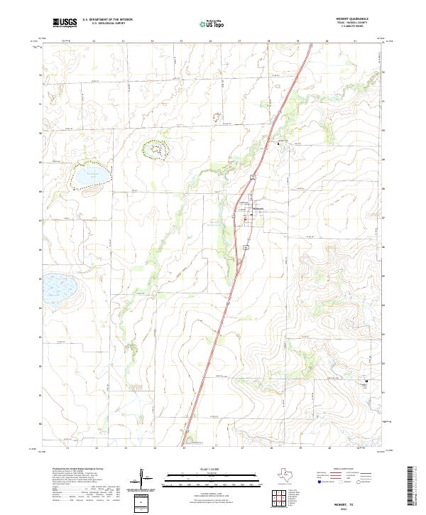
2022 Map of Weinert
USGS Topo · Published 2022About this map
Weinert serves as the central hub of this agricultural landscape in Haskell County, situated along the primary north-south corridor of U.S. 277. The town's grid is anchored by residential and service roads such as W Timmerman, W Bevers, and N Bruested. Surrounding the settlement, the terrain is defined by a series of significant water bodies including Winchester Lake to the west and the namesake Harlan Weinert Lake directly adjacent to the town site. These lakes and the meandering path of Lake Cr indicate the importance of water management for the region's ranching and farming operations.
Find a feature on this map
38 named features on this map. Tap any name to fly to it.
Don’t see what you’re looking for? This feature index may not catch every label — zoom into the map to look around manually.
Map Details
Editions of this 2022 Weinert Map
This is the sole edition of this map. No revisions or reprints were ever made.
Other maps of this area

1954 · Wichita Falls
USGS Topo · 1:250,000

1958 · Wichita Falls
USGS Topo · 1:250,000

1966 · Haskell
USGS Topo · 1:24,000
1966 · Pinkerton
USGS Topo · 1:24,000
1966 · Irby
USGS Topo · 1:24,000

1967 · Rochester
USGS Topo · 1:24,000

1967 · Weinert
USGS Topo · 1:24,000

1967 · Mattson
USGS Topo · 1:24,000

1968 · Munday West
USGS Topo · 1:24,000
1968 · Munday East
USGS Topo · 1:24,000