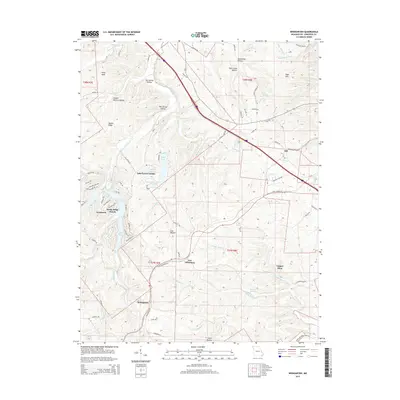
2015 Map of Weingarten
USGS Topo · Published 2015About this map
New Offenburg and Weingarten anchor this section of Ste. Genevieve County, where the landscape is defined by the winding course of Establishment Creek and its many tributaries. The area reflects a mixture of agricultural roots and modern residential development, seen in the transition from established hamlets like Zell to newer lakeside communities such as Lake Forest Estates and Rocky Ridge Ranch. A legacy of extraction is evident at the Copper Mine located near Copper Mine Cr, while names like Moonshine Hollow and Joe Schilly Hollow suggest a deep local history of the Ozark foothills. The drainage network is particularly dense here, with Flint Bottom Cr and the River aux Vases cutting through the terrain, supported by reliable water sources like Schwent Spring. Rural life is interconnected by a network of named tracks such as Old Potosi Rd and New Offenburg Rd.
Find a feature on this map
92 named features on this map. Tap any name to fly to it.
Don’t see what you’re looking for? This feature index may not catch every label — zoom into the map to look around manually.
Map Details
Editions of this 2015 Weingarten Map
This is the sole edition of this map. No revisions or reprints were ever made.
Other maps of this area

1904 · Farmington
USGS Topo · 1:62,500

1906 · Farmington
USGS Topo · 1:62,500

1907 · Weingarten
USGS Topo · 1:62,500

1909 · Weingarten
USGS Topo · 1:62,500

1915 · Renault
USGS Topo · 1:62,500

1915 · Crystal City
USGS Topo · 1:62,500

1940 · Renault
USGS Topo · 1:62,500

1949 · Saint Louis
USGS Topo · 1:250,000

1949 · Rolla
USGS Topo · 1:250,000

1949 · Crystal City
USGS Topo · 1:62,500