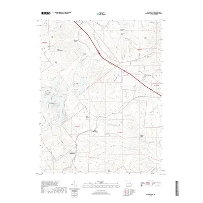
2017 Map of Weingarten
USGS Topo · Published 2017About this map
Bloomsdale and the surrounding Ste. Genevieve County countryside are defined by a complex network of creeks and hollows that historically shaped local settlement patterns. Small communities like New Offenburg, Weingarten, and Zell are scattered across a landscape where industry and agriculture meet. Evidence of the area's extraction history is preserved at the Copper Mine site near Copper Mine Cr, while names like Moonshine Hollow and Joe Schilly Hollow hint at the personal histories of the rugged terrain. To the west, the Grayhawk area shows more contemporary development around a series of recreational water bodies including Lake Susan, Lake Anne, and Lake Ocie. This map captures the intersection of traditional crossroads and 21st-century infrastructure, with Establishment Creek and the River aux Vases providing the primary drainage for the undulating ridges of Deakin Ridge and the Sugar Hills.
Find a feature on this map
86 named features on this map. Tap any name to fly to it.
Don’t see what you’re looking for? This feature index may not catch every label — zoom into the map to look around manually.
Map Details
Editions of this 2017 Weingarten Map
This is the sole edition of this map. No revisions or reprints were ever made.
Other maps of this area

1904 · Farmington
USGS Topo · 1:62,500

1906 · Farmington
USGS Topo · 1:62,500

1907 · Weingarten
USGS Topo · 1:62,500

1909 · Weingarten
USGS Topo · 1:62,500

1915 · Renault
USGS Topo · 1:62,500

1915 · Crystal City
USGS Topo · 1:62,500

1940 · Renault
USGS Topo · 1:62,500

1949 · Saint Louis
USGS Topo · 1:250,000

1949 · Rolla
USGS Topo · 1:250,000

1949 · Crystal City
USGS Topo · 1:62,500