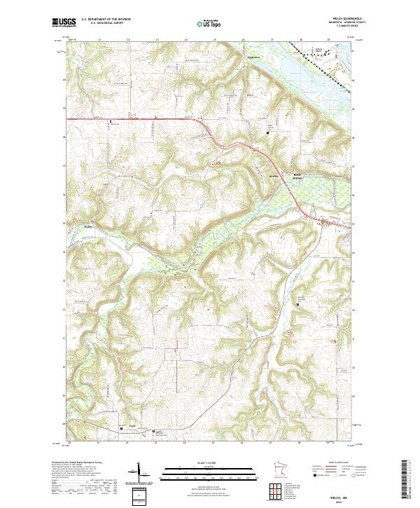
2022 Map of Welch
USGS Topo · Published 2022About this map
The confluence of the Cannon River and the Vermillion River creates a complex network of waterways and low-lying land near the northern border of Goodhue County. This landscape is defined by the braided channels of the Vermillion Slough and Buffalo Slough, which weave around Prairie Island and several small lakes like Brunner Lake and Wildcat Lake. The settlement of Welch sits at a bend in the Cannon River, while further south, the village of Vasa serves as a local hub.
Find a feature on this map
95 named features on this map. Tap any name to fly to it.
Don’t see what you’re looking for? This feature index may not catch every label — zoom into the map to look around manually.
Map Details
Editions of this 2022 Welch Map
This is the sole edition of this map. No revisions or reprints were ever made.
Other maps of this area

1944 · Red Wing
USGS Topo · 1:62,500

1952 · Red Wing
USGS Topo · 1:62,500

1953 · Saint Paul
USGS Topo · 1:250,000

1957 · Hastings
USGS Topo · 1:62,500

1959 · Saint Paul
USGS Topo · 1:250,000

1968 · Goodhue East
USGS Topo · 1:24,000

1968 · White Rock
USGS Topo · 1:24,000
1968 · Goodhue West
USGS Topo · 1:24,000
1974 · Miesville
USGS Topo · 1:24,000
1974 · Red Wing
USGS Topo · 1:24,000