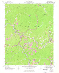
2023 Map of Welch
USGS Topo · Published 2023About this map
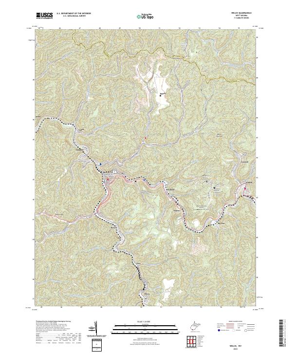
Welch serves as the focal point of this McDowell County landscape, where the confluence of the Tug Fork and Elkhorn Creek historically shaped the development of this southern West Virginia coalfield region. The map captures the dense settlement patterns that follow the narrow valley floors, including the communities of Hemphill, Maitland, Superior, and Havaco. These towns are inextricably linked by a network of local roads and rail corridors, such as Big Four, which trace the winding waterways. Institutional landmarks like the McDowell County Courthouse and the McDowell County Magistrate Court anchor the downtown district. On the higher elevations above the river valleys, the landscape transitions to named ridges and peaks such as Belcher Mountain and Indian Ridge. Here, local heritage is preserved at the New Belcher Mountain Community Cem and Old Belcher Mountain Community Cem, providing valuable data points for those researching family lineages in the heart of the Appalachians.
Find a feature on this map
104 named features on this map. Tap any name to fly to it.
Don’t see what you’re looking for? This feature index may not catch every label — zoom into the map to look around manually.
Map Details
Editions of this 2023 Welch Map
This is the sole edition of this map. No revisions or reprints were ever made.
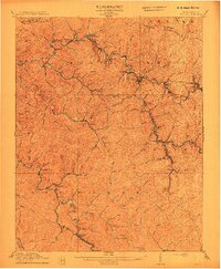
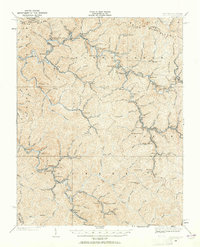
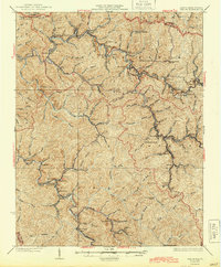
Historical Maps of Maitland Through Time
5 maps found