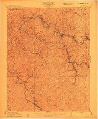
1912 Map of Welch
USGS Topo · Published 1912About this map
Welch serves as the central hub of this coal-country survey, where the Norfolk and Western RR snakes through tight mountain valleys to connect a dense network of company towns and shipping points. The landscape is defined by the steep ridges of Indian Ridge and the winding course of the Tug Fork, which dictated the placement of every settlement and rail siding. Early 20th-century life in McDowell County is etched into the map through numerous small communities like Hemphill, Marytown, and Davy. To the south, along the waters of Adkin Fork and Big Creek, intensive development is evident at Gary, Elbert, and Filbert. This map captures the region at the height of the early Appalachian coal boom, documenting the precise location of post offices like Hallsville PO and railroad junctions such as Clear Fork Junc before the landscape was further altered by decades of extraction.
Find a feature on this map
102 named features on this map. Tap any name to fly to it.
Don’t see what you’re looking for? This feature index may not catch every label — zoom into the map to look around manually.
Map Details
Editions of this 1912 Welch Map
2 editions found

Other maps of this area

1887 · Pocahontas
USGS Topo · 1:125,000

1891 · Tazewell
USGS Topo · 1:125,000

1891 · Pocahontas
USGS Topo · 1:125,000

1891 · Oceana
USGS Topo · 1:125,000

1891 · Raleigh
USGS Topo · 1:125,000

1893 · Oceana
USGS Topo · 1:125,000

1894 · Pocahontas
USGS Topo · 1:125,000

1895 · Tazewell
USGS Topo · 1:125,000

1895 · Pocahontas
USGS Topo · 1:125,000

1897 · Tazewell
USGS Topo · 1:125,000