1912 Map of Welch
USGS Topo · Published 1912About this map
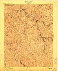
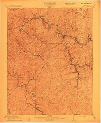
Welch serves as the focal point of this 1912 survey, situated at the confluence of Elkhorn Creek and the Tug Fork. This era in McDowell County is defined by the extensive reach of the Norfolk and Western RR, which snakes through the narrow valleys to serve a dense network of coal-related settlements. Places like Coalwood, Gary, and Kimball are linked by the rail lines that follow the winding paths of Browns Creek and the Sandy River. The topography is marked by prominent high points such as Hensley Knob and the long stretch of Indian Ridge, which forms the boundary with Wyoming County. This map documents the early 20th-century landscape of the West Virginia coalfields, showing established post offices like Yukon PO and Hallsville PO alongside numerous small rail stops and industrial hamlets.
Find a feature on this map
84 named features on this map. Tap any name to fly to it.
Don’t see what you’re looking for? This feature index may not catch every label — zoom into the map to look around manually.
Map Details
Editions of this 1912 Welch Map
2 editions found
Other maps of this area

1887 · Pocahontas
USGS Topo · 1:125,000

1891 · Tazewell
USGS Topo · 1:125,000

1891 · Pocahontas
USGS Topo · 1:125,000

1891 · Oceana
USGS Topo · 1:125,000

1891 · Raleigh
USGS Topo · 1:125,000

1893 · Oceana
USGS Topo · 1:125,000

1894 · Pocahontas
USGS Topo · 1:125,000

1895 · Tazewell
USGS Topo · 1:125,000

1895 · Pocahontas
USGS Topo · 1:125,000

1897 · Tazewell
USGS Topo · 1:125,000