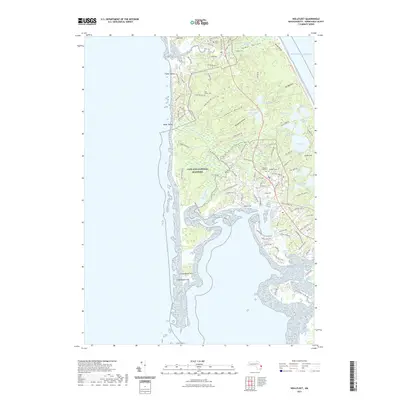
2021 Map of Wellfleet
USGS Topo · Published 2021About this map
The Cape Cod National Seashore dominates this 2021 landscape, preserving the complex glacial topography of the Outer Cape. The terrain is defined by dramatic depressions and ridges like Lombard Hollow and Great Beach Hill, alongside numerous kettle ponds such as Horseleech Pond, Gull Pond, and Slough Pond. Along the western shoreline, Duck Harbor and the Herring River provide a glimpse into the tidal ecosystems that have long supported local life. For genealogists and local historians, several burial grounds are carefully documented, including Snow Cem near Pamet Hollow and the Pleasant Hill Cem complex. The map meticulously traces the network of local roads such as Bound Brook Island Rd and Pole Dike Rd, which connect these inland water bodies to the vast Atlantic Ocean coast.
Find a feature on this map
106 named features on this map. Tap any name to fly to it.
Don’t see what you’re looking for? This feature index may not catch every label — zoom into the map to look around manually.
Map Details
Editions of this 2021 Wellfleet Map
This is the sole edition of this map. No revisions or reprints were ever made.
Other maps of this area

1887 · Wellfleet
USGS Topo · 1:62,500

1887 · Provincetown
USGS Topo · 1:62,500

1889 · Provincetown
USGS Topo · 1:62,500

1889 · Wellfleet
USGS Topo · 1:62,500

1893 · Wellfleet
USGS Topo · 1:62,500

1898 · Provincetown
USGS Topo · 1:62,500

1942 · Cape Cod Bay
USGS Topo · 1:125,000

1942 · Nauset
USGS Topo · 1:125,000

1944 · Orleans
USGS Topo · 1:31,680

1944 · Provincetown
USGS Topo · 1:31,680