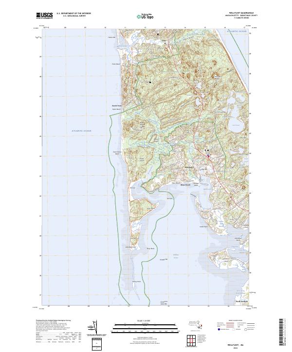
2024 Map of Wellfleet
USGS Topo · Published 2024About this map
Wellfleet and Truro are the primary hubs of this coastal survey, where the complex interplay of water and sand defines the lower Cape. The landscape is dominated by the Cape Cod National Seashore, preserving a transition from the rolling heights of Tom Hill and Gross Hill to the expansive salt marshes of the Herring River Marshes. Marine features are remarkably detailed, showing the precarious spit of Jeremy Point and the tidal reaches of The Gut and Old Saw. The inner harbor is shielded by Smalley Bar and Indian Neck, while the landward side reveals a network of kettle ponds such as Gull Pond and Horseleech Pond. For researchers, the map traces the modern path of the Cape Cod Rail Trail alongside older landmarks like Cannon Hill and several local burying grounds, including Oakdale Cem and Pine Grove Cem.
Find a feature on this map
127 named features on this map. Tap any name to fly to it.
Don’t see what you’re looking for? This feature index may not catch every label — zoom into the map to look around manually.
Map Details
Editions of this 2024 Wellfleet Map
This is the sole edition of this map. No revisions or reprints were ever made.
Other maps of this area

1887 · Wellfleet
USGS Topo · 1:62,500

1887 · Provincetown
USGS Topo · 1:62,500

1889 · Provincetown
USGS Topo · 1:62,500

1889 · Wellfleet
USGS Topo · 1:62,500

1893 · Wellfleet
USGS Topo · 1:62,500

1898 · Provincetown
USGS Topo · 1:62,500

1942 · Cape Cod Bay
USGS Topo · 1:125,000

1942 · Nauset
USGS Topo · 1:125,000

1944 · Orleans
USGS Topo · 1:31,680

1944 · Provincetown
USGS Topo · 1:31,680