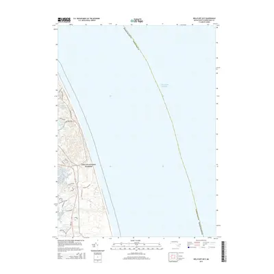
2015 Map of Wellfleet OE E
USGS Topo · Published 2015About this map
Cape Cod National Seashore dominates the narrow coastal strip of the outer cape, where the high Atlantic cliffs meet the shoreline. This 2015 study traces the intricate network of local roads and natural landmarks that define the area's geography, including Marconi Beach and the historic path of Marconi Station Rd. Inland, a cluster of kettle ponds such as Great Pond, Spectacle Pond, and Duck Pond dot the landscape, illustrating the glacial legacy of the peninsula. The map further documents the tidal inlets of Fresh Brook and Hatches Cr as they drain toward the western marshes. Local thoroughfares like Newcomb Hollow Rd and Ocean View Dr provide access to the coastline, while family-named routes like Lieutenant Island Rd hint at the long-standing community ties to this specific stretch of Barnstable County.
Find a feature on this map
30 named features on this map. Tap any name to fly to it.
Don’t see what you’re looking for? This feature index may not catch every label — zoom into the map to look around manually.
Map Details
Editions of this 2015 Wellfleet OE E Map
This is the sole edition of this map. No revisions or reprints were ever made.
Other maps of this area

1887 · Wellfleet
USGS Topo · 1:62,500

1887 · Provincetown
USGS Topo · 1:62,500

1889 · Provincetown
USGS Topo · 1:62,500

1889 · Wellfleet
USGS Topo · 1:62,500

1893 · Wellfleet
USGS Topo · 1:62,500

1898 · Provincetown
USGS Topo · 1:62,500

1942 · Cape Cod Bay
USGS Topo · 1:125,000

1942 · Nauset
USGS Topo · 1:125,000

1944 · Orleans
USGS Topo · 1:31,680

1944 · Wellfleet
USGS Topo · 1:31,680