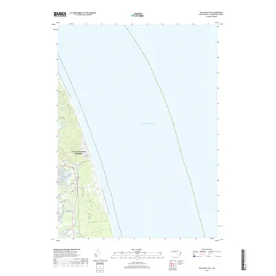
2018 Map of Wellfleet OE E
USGS Topo · Published 2018About this map
Atlantic Ocean waters dominate this coastal landscape, where the shifting sands and salt marshes of the Cape Cod National Seashore meet the eastern edge of the peninsula. Inland from the surf, a series of freshwater kettle ponds—including Kinnacum Pond, Spectacle Pond, and Duck Pond—illustrate the glacial geography typical of this region. The settlement pattern is defined by a network of local roads such as Ocean View Dr and Old Kings Hwy, which connect small communities to the shore. For genealogists, the South Wellfleet Cem is a prominent landmark, situated near the headwaters of Blackfish Cr. The southern portion of the sheet reveals a complex wetland system comprising the Loagy Bay Marshes, Fresh Brook, and Silver Spring Brook Marshes, showing how tidal inlets and coastal streams shape the local topography and drainage.
Find a feature on this map
28 named features on this map. Tap any name to fly to it.
Don’t see what you’re looking for? This feature index may not catch every label — zoom into the map to look around manually.
Map Details
Editions of this 2018 Wellfleet OE E Map
This is the sole edition of this map. No revisions or reprints were ever made.
Other maps of this area

1887 · Wellfleet
USGS Topo · 1:62,500

1887 · Provincetown
USGS Topo · 1:62,500

1889 · Provincetown
USGS Topo · 1:62,500

1889 · Wellfleet
USGS Topo · 1:62,500

1893 · Wellfleet
USGS Topo · 1:62,500

1898 · Provincetown
USGS Topo · 1:62,500

1942 · Cape Cod Bay
USGS Topo · 1:125,000

1942 · Nauset
USGS Topo · 1:125,000

1944 · Orleans
USGS Topo · 1:31,680

1944 · Wellfleet
USGS Topo · 1:31,680