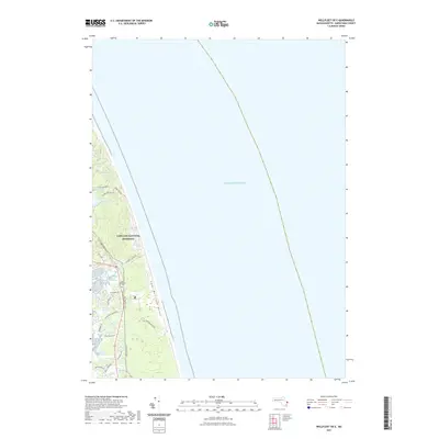
2021 Map of Wellfleet OE E
USGS Topo · Published 2021About this map
The Cape Cod National Seashore dominates this coastal landscape, where the Atlantic's edge meets a complex system of kettle ponds and tidal marshes. Just inland from the Camp Wellfleet Dunes, a cluster of freshwater bodies including Kinnacum Pond, Spectacle Pond, and Duck Pond indicate the area's glacial geography. Modern recreation and conservation patterns are clear, with the Cape Cod Rail Trl cutting through the terrain and local roads like Cahoon Hollow Rd and Lecount Hollow Rd providing access to the shore.
Find a feature on this map
30 named features on this map. Tap any name to fly to it.
Don’t see what you’re looking for? This feature index may not catch every label — zoom into the map to look around manually.
Map Details
Editions of this 2021 Wellfleet OE E Map
This is the sole edition of this map. No revisions or reprints were ever made.
Other maps of this area

1887 · Wellfleet
USGS Topo · 1:62,500

1887 · Provincetown
USGS Topo · 1:62,500

1889 · Provincetown
USGS Topo · 1:62,500

1889 · Wellfleet
USGS Topo · 1:62,500

1893 · Wellfleet
USGS Topo · 1:62,500

1898 · Provincetown
USGS Topo · 1:62,500

1942 · Cape Cod Bay
USGS Topo · 1:125,000

1942 · Nauset
USGS Topo · 1:125,000

1944 · Orleans
USGS Topo · 1:31,680

1944 · Wellfleet
USGS Topo · 1:31,680