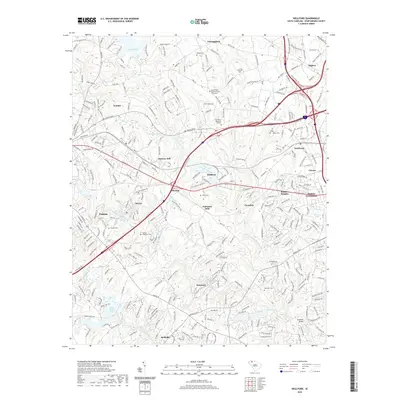
2020 Map of Wellford
USGS Topo · Published 2020About this map
The North Tyger River, Middle Tyger River, and South Tyger River converge in this part of Spartanburg County, creating a landscape historically defined by textile production and water power. Industrial centers like Jackson Mill, Fairmont Mills, and Startex are prominent, illustrating the Piedmont's deep-rooted mill culture. For genealogists, the map is particularly detailed regarding burial sites, including the Mount Zion Baptist Church Graveyard, Nazareth Cem, and several family-named locations such as the Penney - McMillan Cem. Residential development and local infrastructure connect established towns like Lyman, Wellford, and Duncan. Notable water features such as Lake Cooley and Berry Shoals Pond contrast with the dense network of secondary roads and local connectors that trace the area's growth.
Find a feature on this map
317 named features on this map. Tap any name to fly to it.
Don’t see what you’re looking for? This feature index may not catch every label — zoom into the map to look around manually.
Map Details
Editions of this 2020 Wellford Map
This is the sole edition of this map. No revisions or reprints were ever made.
Other maps of this area

1907 · Saluda
USGS Topo · 1:125,000

1935 · Greer
USGS Topo · 1:48,000

1938 · Greer
USGS Topo · 1:62,500

1941 · Spartanburg
USGS Topo · 1:250,000

1947 · Spartanburg
USGS Topo · 1:62,500

1949 · Spartanburg
USGS Topo · 1:24,000

1949 · Spartanburg
USGS Topo · 1:62,500

1953 · Spartanburg
USGS Topo · 1:250,000

1953 · Charlotte
USGS Topo · 1:250,000

1954 · Charlotte
USGS Topo · 1:250,000