2024 Map of Wellford
USGS Topo · Published 2024About this map
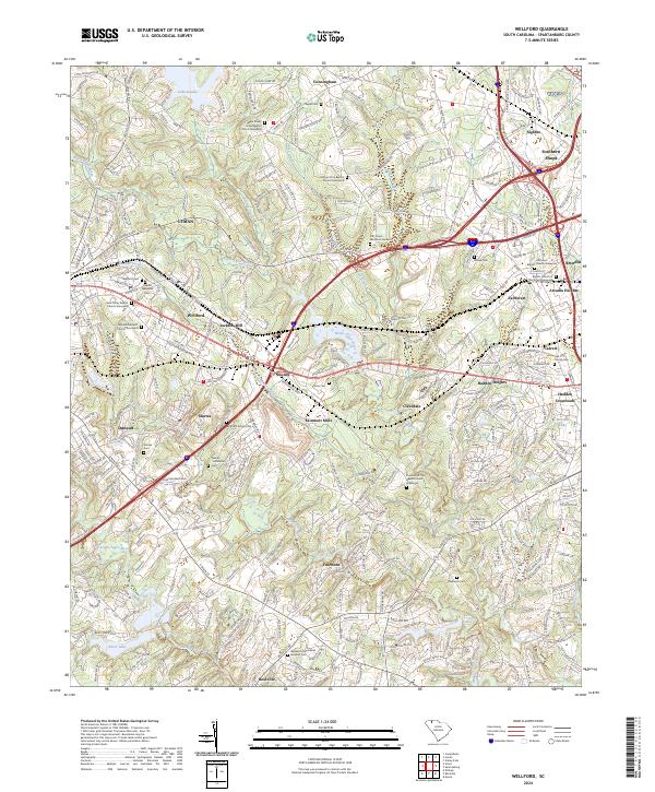
The North Tyger River, Middle Tyger River, and South Tyger River converge in this western Spartanburg County landscape, defining a region where textile manufacturing and rural congregational life have long intersected. Industrial hubs like Jackson Mill, Startex, and Fairmont Mills reflect the area's economic heritage, while a high density of historic burying grounds, such as the Upper Shady Grove Baptist Church Graveyard and McElrath Family Cem, offer invaluable data for genealogical research. The map captures the transition from older crossroads like Snoddy and Hadden Crossroads to the modern residential corridors of Wellford and Duncan. To the north, the waters of Lake Cooley provide a distinct contrast to the clustered settlements and historic church sites like the New Trinity Baptist Church Graveyard that anchor these local communities.
Find a feature on this map
312 named features on this map. Tap any name to fly to it.
Don’t see what you’re looking for? This feature index may not catch every label — zoom into the map to look around manually.
Map Details
Editions of this 2024 Wellford Map
This is the sole edition of this map. No revisions or reprints were ever made.