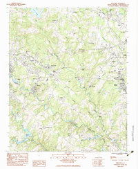
1983 Map of Wellford
USGS Topo · Published 1983About this map
Industrial and agricultural life in Spartanburg County centers on the convergence of the North Tyger River, Middle Tyger River, and South Tyger River. This landscape is defined by the legacy of textile manufacturing at Jackson Mill and the community of Startex, where the river's path dictated the placement of mill works and worker housing. The northern territory around Cunningham remains more open, characterized by family-named landmarks and rural congregations like Upper Shady Grove Ch.
Find a feature on this map
63 named features on this map. Tap any name to fly to it.
Don’t see what you’re looking for? This feature index may not catch every label — zoom into the map to look around manually.
Map Details
Editions of this 1983 Wellford Map
This is the sole edition of this map. No revisions or reprints were ever made.
Other maps of this area

1907 · Saluda
USGS Topo · 1:125,000

1935 · Greer
USGS Topo · 1:48,000

1938 · Greer
USGS Topo · 1:62,500

1941 · Spartanburg
USGS Topo · 1:250,000

1947 · Spartanburg
USGS Topo · 1:62,500

1949 · Spartanburg
USGS Topo · 1:24,000

1949 · Spartanburg
USGS Topo · 1:62,500

1953 · Spartanburg
USGS Topo · 1:250,000

1953 · Charlotte
USGS Topo · 1:250,000

1954 · Charlotte
USGS Topo · 1:250,000