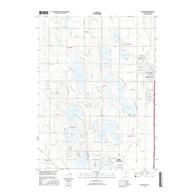
2016 Map of Wellington
USGS Topo · Published 2016About this map
Waverly and the northern outskirts of Fort Collins anchor this landscape, where the High Plains meet the agricultural infrastructure of the Colorado Front Range. The map reveals an intricate network of irrigation and storage, dominated by the North Poudre and Windsor systems. Large-scale water management is evident in features like N Poudre Reservoir Number 6 and Windsor Reservoir Number 8, which dictate the local topography alongside the Windsor Ditch and Jackson Ditch. In the eastern portion, the town of Wellington is shown with its residential street grid including Cleveland Ave and Roosevelt Ave. A small touch of local genealogy is preserved at the Reu Family Cem, located west of Douglass Lake Reservoir Number 10. The reliance on surface water is the defining characteristic of this region's development and land use.
Find a feature on this map
150 named features on this map. Tap any name to fly to it.
Don’t see what you’re looking for? This feature index may not catch every label — zoom into the map to look around manually.
Map Details
Editions of this 2016 Wellington Map
This is the sole edition of this map. No revisions or reprints were ever made.
Other maps of this area

1906 · Fort Collins
USGS Topo · 1:62,500

1907 · Livermore
USGS Topo · 1:125,000

1908 · Fort Collins
USGS Topo · 1:62,500

1908 · Eaton
USGS Topo · 1:125,000

1909 · Livermore
USGS Topo · 1:125,000

1910 · Eaton
USGS Topo · 1:125,000

1954 · Greeley
USGS Topo · 1:250,000

1957 · Greeley
USGS Topo · 1:250,000

1958 · Greeley
USGS Topo · 1:250,000

1960 · Livermore
USGS Topo · 1:24,000