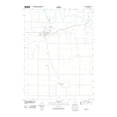
2010 Map of Wellman
USGS Topo · Published 2010About this map
Wellman serves as the central hub of this northern Washington County landscape, where the English River meanders through the northern plains. This early 21st-century documentation illustrates a rural Iowa community anchored by agricultural traditions and a dense network of local landmarks. The area surrounding the town is punctuated by numerous burial grounds, including the Mennonite Cemetery and the Wassonville Cemetery, reflecting the deep generational roots of the local population. Small, dispersed settlements like Daytonville, Lexington, and Pilotsburg are connected by a precise grid of rural roads such as Kiwi Ave and Ginkgo Ave. Along Smith Creek, the terrain transitions from town lots and the Wellman Golf Course to expansive fields and riparian corridors, offering a clear look at the intersection of municipal development and the prairie river system.
Find a feature on this map
38 named features on this map. Tap any name to fly to it.
Don’t see what you’re looking for? This feature index may not catch every label — zoom into the map to look around manually.
Map Details
Editions of this 2010 Wellman Map
This is the sole edition of this map. No revisions or reprints were ever made.
Other maps of this area

1891 · Oxford
USGS Topo · 1:62,500

1891 · Iowa City
USGS Topo · 1:62,500

1894 · Oxford
USGS Topo · 1:62,500

1903 · Fairfax
USGS Topo · 1:125,000

1938 · Iowa City
USGS Topo · 1:62,500

1958 · Davenport
USGS Topo · 1:250,000

1961 · Davenport
USGS Topo · 1:250,000

1962 · Davenport
USGS Topo · 1:250,000

1965 · Williamstown
USGS Topo · 1:24,000

1969 · Kalona
USGS Topo · 1:24,000