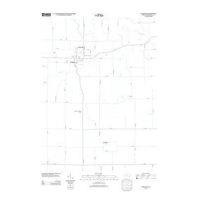
2013 Map of Wellman
USGS Topo · Published 2013About this map
The English River meanders across the northern reaches of this landscape, defining the hydrology of Washington County. The town of Wellman serves as the primary hub, where a grid of streets including 1st St and 9th Ave centers around the local commerce and residency. This area maintains its agricultural character, evidenced by the large rectangular sections of land bounded by roads like Ginkgo Ave and Elm Ave. To the north of the main settlement lies Daytonville, while the small crossroads of Lexington and Pilotsburg punctuate the rural terrain further south and east. Waterways such as Smith Cr and Lime Cr branch off the river system, carving small valleys through the fields. Significant landmarks include the Wellman Golf Course and the Murphy Field Private Airport, showing the modernization of the local community and its recreational infrastructure.
Find a feature on this map
49 named features on this map. Tap any name to fly to it.
Don’t see what you’re looking for? This feature index may not catch every label — zoom into the map to look around manually.
Map Details
Editions of this 2013 Wellman Map
This is the sole edition of this map. No revisions or reprints were ever made.
Other maps of this area

1891 · Oxford
USGS Topo · 1:62,500

1891 · Iowa City
USGS Topo · 1:62,500

1894 · Oxford
USGS Topo · 1:62,500

1903 · Fairfax
USGS Topo · 1:125,000

1938 · Iowa City
USGS Topo · 1:62,500

1958 · Davenport
USGS Topo · 1:250,000

1961 · Davenport
USGS Topo · 1:250,000

1962 · Davenport
USGS Topo · 1:250,000

1965 · Williamstown
USGS Topo · 1:24,000

1969 · Kalona
USGS Topo · 1:24,000