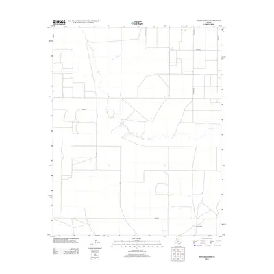
2012 Map of Wells Ranch
USGS Topo · Published 2012About this map
Wells Ranch serves as a primary geographic anchor in this section of Hartley County, reflecting the deep-rooted agricultural and ranching traditions of the Texas Panhandle. The landscape is defined by the winding course of Carrizo Creek, which cuts through the high plains, providing a vital natural drainage system in an otherwise arid environment. This 2012 survey documents a sparse but organized network of rural infrastructure, where long stretches of road like Parker Rd and Telephone Rd align with section lines of the Texas land grid. The naming of local thoroughfares such as Johnson Ln, Richards Ln, and Gandy Rd points to the family-held lands and legacy ranching operations that have shaped the region's history. This map provides a clear record of the modern land divisions and water sources essential to High Plains life.
Find a feature on this map
12 named features on this map. Tap any name to fly to it.
Don’t see what you’re looking for? This feature index may not catch every label — zoom into the map to look around manually.
Map Details
Editions of this 2012 Wells Ranch Map
This is the sole edition of this map. No revisions or reprints were ever made.
Other maps of this area

1954 · Tucumcari
USGS Topo · 1:250,000

1954 · Dalhart
USGS Topo · 1:250,000

1958 · Tucumcari
USGS Topo · 1:250,000

1958 · Dalhart
USGS Topo · 1:250,000

1962 · Dalhart
USGS Topo · 1:250,000

1971 · Syndicate Hills
USGS Topo · 1:24,000

1971 · Beck Ranch
USGS Topo · 1:24,000

1973 · Wharton Ranch
USGS Topo · 1:24,000

1973 · King
USGS Topo · 1:24,000

1973 · Canyon School
USGS Topo · 1:24,000