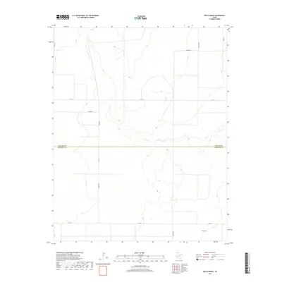
2019 Map of Wells Ranch
USGS Topo · Published 2019About this map
The high plains of the Texas Panhandle are defined here by the crossing of the Dallam Co Hartley Co line, where the landscape transitions from flat tablelands to the winding drainage of Carrizo Cr. This 2019 survey captures the modern ranching infrastructure of the region, anchored by the named Wells Ranch in the southeast. A sparse but essential network of roads, including Fm 1727 and Fm 3110, connects the remote homesteads and cattle operations across the rugged breaks. The naming of local thoroughfares like Telephone Rd and Richards Ln suggests a long history of family-held parcels and early communication lines in this expansive territory. The topographic contours reveal the subtle but significant elevation changes as the land falls away toward the creek bed, a critical water source in this semi-arid environment.
Find a feature on this map
14 named features on this map. Tap any name to fly to it.
Don’t see what you’re looking for? This feature index may not catch every label — zoom into the map to look around manually.
Map Details
Editions of this 2019 Wells Ranch Map
This is the sole edition of this map. No revisions or reprints were ever made.
Other maps of this area

1954 · Tucumcari
USGS Topo · 1:250,000

1954 · Dalhart
USGS Topo · 1:250,000

1958 · Tucumcari
USGS Topo · 1:250,000

1958 · Dalhart
USGS Topo · 1:250,000

1962 · Dalhart
USGS Topo · 1:250,000

1971 · Syndicate Hills
USGS Topo · 1:24,000

1971 · Beck Ranch
USGS Topo · 1:24,000

1973 · Wharton Ranch
USGS Topo · 1:24,000

1973 · King
USGS Topo · 1:24,000

1973 · Canyon School
USGS Topo · 1:24,000