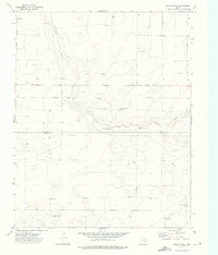
1973 Map of Wells Ranch
USGS Topo · Published 1976About this map
Carrizo Creek meanders through this High Plains landscape, cutting across the border between Dallam and Hartley counties in the early 1970s. This ranching territory is defined by an extensive network of water infrastructure, featuring numerically sequenced wells such as Seventyseven Well and Seventyfive Well. These locations, along with named sites like XIT Bennett Well, underscore the vital importance of groundwater management in this semi-arid region of the Texas Panhandle.
Find a feature on this map
19 named features on this map. Tap any name to fly to it.
Don’t see what you’re looking for? This feature index may not catch every label — zoom into the map to look around manually.
Map Details
Editions of this 1973 Wells Ranch Map
This is the sole edition of this map. No revisions or reprints were ever made.
Other maps of this area

1954 · Tucumcari
USGS Topo · 1:250,000

1954 · Dalhart
USGS Topo · 1:250,000

1958 · Tucumcari
USGS Topo · 1:250,000

1958 · Dalhart
USGS Topo · 1:250,000

1962 · Dalhart
USGS Topo · 1:250,000

1971 · Syndicate Hills
USGS Topo · 1:24,000

1971 · Beck Ranch
USGS Topo · 1:24,000

1973 · Wharton Ranch
USGS Topo · 1:24,000

1973 · King
USGS Topo · 1:24,000

1973 · Canyon School
USGS Topo · 1:24,000