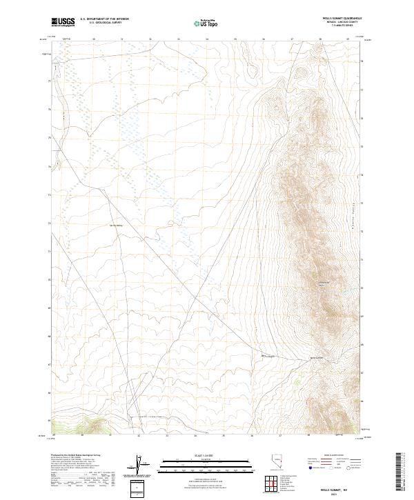
2021 Map of Wells Summit
USGS Topo · Published 2021About this map
Limestone Hills form a central spine across this portion of eastern Lincoln County, dividing two significant basins in the Nevada interior. To the west, the broad expanse of Spring Valley is marked by a complex network of intermittent water features, while the eastern edge of the quadrangle drops into Hamlin Valley. This landscape is defined by its drainage patterns and topographical transitions, most notably at the Wells Summit mountain pass. The terrain funnels seasonal runoff through features such as Daves Canyon and Hude Wash, illustrating the characteristic hydrography of the Great Basin region. This 2021 update by the U.S. Geological Survey provides a precise view of the modern boundaries and land survey system across Townships 7, 8, and 9 North.
Find a feature on this map
12 named features on this map. Tap any name to fly to it.
Don’t see what you’re looking for? This feature index may not catch every label — zoom into the map to look around manually.
Map Details
Editions of this 2021 Wells Summit Map
This is the sole edition of this map. No revisions or reprints were ever made.
Other maps of this area

1956 · Lund
USGS Topo · 1:250,000

1960 · Lund
USGS Topo · 1:250,000

1972 · Rosencrans Knolls
USGS Topo · 1:24,000

1972 · Hyde Well
USGS Topo · 1:24,000

1972 · Big Springs
USGS Topo · 1:24,000

1973 · Horse Corral Pass
USGS Topo · 1:24,000

1973 · Atlanta
USGS Topo · 1:24,000

1973 · Indian Springs Knolls
USGS Topo · 1:24,000

1973 · Red Ledges
USGS Topo · 1:24,000
1973 · Wells Summit
USGS Topo · 1:24,000