
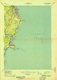
1944 Map of Wells
USGS Topo · Published 1944About this map
The Boston and Maine RR cuts a straight path parallel to the Atlantic coastline, anchoring the mid-1940s development of this York County region. The landscape transitions from the tidal marshes of the Webhannet River and Merriland River to the inland agricultural and residential clusters. At the shoreline, the community of Wells Beach (Webhannet PO) sits on a narrow barrier strip, while inland hubs like Wells and Moody are connected by established routes like Sanford Rd and Elms Road.
Find a feature on this map
46 named features on this map. Tap any name to fly to it.
Don’t see what you’re looking for? This feature index may not catch every label — zoom into the map to look around manually.
Map Details
Editions of this 1944 Wells Map
This is the sole edition of this map. No revisions or reprints were ever made.
Other maps of this area

1891 · Biddeford
USGS Topo · 1:62,500

1891 · Kennebunk
USGS Topo · 1:62,500

1893 · Kennebunk
USGS Topo · 1:62,500

1893 · York
USGS Topo · 1:62,500

1893 · Biddeford
USGS Topo · 1:62,500

1898 · Kennebunk
USGS Topo · 1:62,500

1920 · York
USGS Topo · 1:62,500

1941 · Biddeford
USGS Topo · 1:62,500

1941 · Kennebunk
USGS Topo · 1:62,500
1944 · York Beach
USGS Topo · 1:24,000