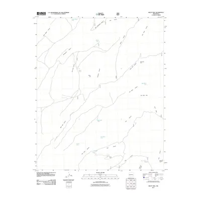
2011 Map of Welty Hill
USGS Topo · Published 2011About this map
Welty Hill rises above a landscape defined by an intricate network of drainages and water-management features within this section of Socorro County. The land is marked by numerous tanks, such as Blazes Tank and Sim Yaten Tank, which support livestock in an arid environment cut by deep canyons like Little Pigeon Canyon and West Red Canyon. Human presence is sparse, centered on infrastructure like Pinyon Corral and the Forest 478 Rd, with Pine Cabin serving as a lone named outpost in the southeast. The map reveals the logistical realities of high-desert ranching, where seasonal water sources and named landmarks like Red John Box and the Sim Yaten Hills provide necessary orientation for those working the land.
Find a feature on this map
33 named features on this map. Tap any name to fly to it.
Don’t see what you’re looking for? This feature index may not catch every label — zoom into the map to look around manually.
Map Details
Editions of this 2011 Welty Hill Map
This is the sole edition of this map. No revisions or reprints were ever made.
Other maps of this area

1954 · Tularosa
USGS Topo · 1:250,000

1958 · Tularosa
USGS Topo · 1:250,000

1964 · Welty Hill
USGS Topo · 1:24,000

1964 · Vicks Peak
USGS Topo · 1:24,000

1964 · Bay Buck Peaks
USGS Topo · 1:24,000

1964 · Blue Mountain
USGS Topo · 1:24,000

1964 · Montoya Butte
USGS Topo · 1:24,000
1964 · Grassy Lookout
USGS Topo · 1:24,000

1965 · Oak Peak
USGS Topo · 1:24,000

1965 · Dusty
USGS Topo · 1:24,000