
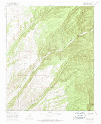
1964 Map of Welty Hill
USGS Topo · Published 1966About this map
The high canyons and ridges of the Cibola National Forest define this 1964 survey of the Socorro County landscape. The area is characterized by a series of named water catchment tanks, such as Rock Spring Tank and Antelope Tank, which highlight the importance of water management in this arid environment. The terrain rises to notable peaks like Welty Hill and the Sim Yaten Hills, while the drainage system is a complex network of canyons and draws. Significant among these are Red John Box Canyon and the deep Sim Yaten Canyon. The map reveals a land utilized for its natural resources and range, marked by features such as Drill Draw and the various stock tanks that supported local ranching or wildlife management in the mid-1960s.
Find a feature on this map
25 named features on this map. Tap any name to fly to it.
Don’t see what you’re looking for? This feature index may not catch every label — zoom into the map to look around manually.
Map Details
Editions of this 1964 Welty Hill Map
2 editions found
Other maps of this area

1954 · Tularosa
USGS Topo · 1:250,000

1958 · Tularosa
USGS Topo · 1:250,000

1964 · Vicks Peak
USGS Topo · 1:24,000

1964 · Bay Buck Peaks
USGS Topo · 1:24,000

1964 · Blue Mountain
USGS Topo · 1:24,000

1964 · Montoya Butte
USGS Topo · 1:24,000
1964 · Grassy Lookout
USGS Topo · 1:24,000

1965 · Oak Peak
USGS Topo · 1:24,000

1965 · Dusty
USGS Topo · 1:24,000

1979 · San Mateo Mountains
USGS Topo · 1:100,000