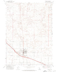
1971 Map of Wendell
USGS Topo · Published 1974About this map
Agricultural development and industrial infrastructure define the landscape around Wendell in the early 1970s. The town's grid is centered on its commercial and civic core, featuring a local Hs, several churches, and a Park. Its position as a shipping hub for Idaho's high desert farmland is evidenced by the Union Pacific Railroad line, which services a prominent Grain Elevator and local Station.
Find a feature on this map
27 named features on this map. Tap any name to fly to it.
Don’t see what you’re looking for? This feature index may not catch every label — zoom into the map to look around manually.
Map Details
Editions of this 1971 Wendell Map
2 editions found
Other maps of this area

1949 · Thousand Springs
USGS Topo · 1:24,000

1949 · Gooding Butte
USGS Topo · 1:24,000

1949 · Tuttle
USGS Topo · 1:24,000

1950 · Gooding Butte
USGS Topo · 1:24,000

1950 · Niagara Springs
USGS Topo · 1:24,000

1950 · Jerome
USGS Topo · 1:24,000

1950 · Jerome
USGS Topo · 1:62,500

1951 · Thousand Springs
USGS Topo · 1:24,000

1951 · Tuttle
USGS Topo · 1:24,000

1954 · Thousand Springs
USGS Topo · 1:24,000