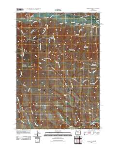
2011 Map of Wendt Butte
USGS Topo · Published 2011About this map
Burnt River winds through this high-desert landscape in Malheur County, accompanied by a complex network of irrigation infrastructure such as the Eldorado Ditch, Mill Ditch, and Clement Ditch. These waterways highlight the essential role of water management in a region defined by arid flats and volcanic prominences. The terrain rises from Schofield Flat and Miller Flat toward significant heights at Wendt Butte and Baldy Mountain, where the drainage patterns of Alder Creek and Hugg Creek have carved numerous gulches. For those interested in local history, the Bridgeport Cemetery stands near the northern boundary, while landmarks like Three Pine Butte and Mahogany Flat provide geographic anchors in a terrain crisscrossed by access routes like Malheur Reservoir Rd and Porters Gulch Rd. This 2011 survey illustrates the continued reliance on the historical ditch system for ranching and agriculture.
Find a feature on this map
57 named features on this map. Tap any name to fly to it.
Don’t see what you’re looking for? This feature index may not catch every label — zoom into the map to look around manually.
Map Details
Editions of this 2011 Wendt Butte Map
This is the sole edition of this map. No revisions or reprints were ever made.
Other maps of this area

1901 · Baker City
USGS Topo · 1:125,000

1955 · Baker
USGS Topo · 1:250,000

1959 · Baker
USGS Topo · 1:250,000

1964 · Bridgeport
USGS Topo · 1:62,500

1964 · Ironside
USGS Topo · 1:62,500

1967 · French Gulch
USGS Topo · 1:24,000

1967 · Dooley Mtn
USGS Topo · 1:24,000
1967 · Brannan Gulch
USGS Topo · 1:24,000

1980 · Brogan
USGS Topo · 1:100,000

1981 · Baker
USGS Topo · 1:100,000