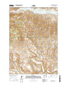
2017 Map of Wendt Butte
USGS Topo · Published 2017About this map
The Burnt River flows through the northern edge of this high-altitude landscape along the border of Baker and Malheur counties. A complex system of historical water management defines the valley floor, evidenced by numerous irrigation channels including Eldorado Ditch, Clarks Cr Ditch, and Lynns Ditch. These waterways reflect the region's agricultural and mining history, where diverting water was essential for survival and industry.
Find a feature on this map
62 named features on this map. Tap any name to fly to it.
Don’t see what you’re looking for? This feature index may not catch every label — zoom into the map to look around manually.
Map Details
Editions of this 2017 Wendt Butte Map
This is the sole edition of this map. No revisions or reprints were ever made.
Other maps of this area

1901 · Baker City
USGS Topo · 1:125,000

1955 · Baker
USGS Topo · 1:250,000

1959 · Baker
USGS Topo · 1:250,000

1964 · Bridgeport
USGS Topo · 1:62,500

1964 · Ironside
USGS Topo · 1:62,500

1967 · French Gulch
USGS Topo · 1:24,000

1967 · Dooley Mtn
USGS Topo · 1:24,000
1967 · Brannan Gulch
USGS Topo · 1:24,000

1980 · Brogan
USGS Topo · 1:100,000

1981 · Baker
USGS Topo · 1:100,000