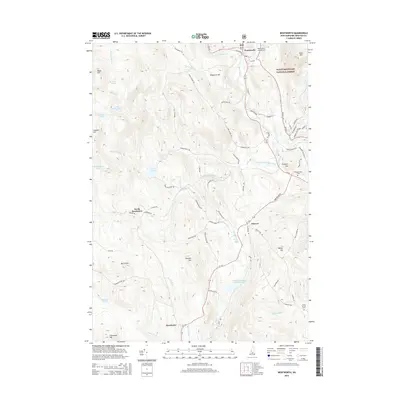
2015 Map of Wentworth
USGS Topo · Published 2015About this map
Wentworth and the rural crossroads of Cheever and Dorchester sit at the intersection of steep mountain terrain and fertile river valleys in this Grafton County landscape. The eastern portion of the map is defined by the White Mountain National Forest, while the Baker River and its south branch provide the primary corridor for settlements and transport. Historical infrastructure is well-preserved in the naming of local routes, including Old Railroad Grd and Hearse House Rd, reflecting a landscape deeply shaped by 19th-century transit and community services. Genealogists can locate family sites near Pleasant View Cem or the North Groton Cem. The geography transitions from the higher peaks of Ames Mtn and Black Hill down to water features like the South Branch Baker River Reservoir and McCutcheon Pond, illustrating the hydraulic and agricultural character of these New Hampshire highlands.
Find a feature on this map
75 named features on this map. Tap any name to fly to it.
Don’t see what you’re looking for? This feature index may not catch every label — zoom into the map to look around manually.
Map Details
Editions of this 2015 Wentworth Map
This is the sole edition of this map. No revisions or reprints were ever made.
Other maps of this area

1927 · Cardigan
USGS Topo · 1:62,500

1927 · Mascoma
USGS Topo · 1:62,500

1928 · Rumney
USGS Topo · 1:62,500

1930 · Cardigan
USGS Topo · 1:62,500

1931 · Mt. Cube
USGS Topo · 1:62,500

1932 · Mascoma
USGS Topo · 1:62,500

1932 · Rumney
USGS Topo · 1:62,500

1933 · Mt. Cube
USGS Topo · 1:62,500

1949 · Portland
USGS Topo · 1:250,000

1950 · Glens Falls
USGS Topo · 1:250,000