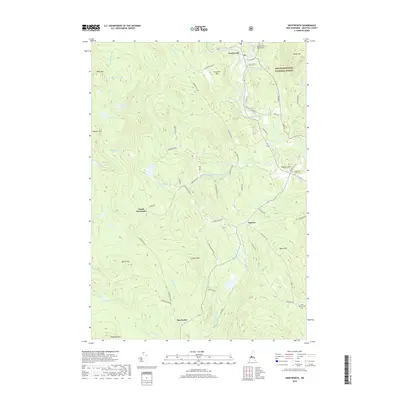
2018 Map of Wentworth
USGS Topo · Published 2018About this map
The Baker River corridor defines the eastern edge of this landscape, winding past the village of Wentworth and the Baker Floodwater Reservoir Site. This area of Grafton County is characterized by high peaks and ridges such as Streeter Mtn, Ames Mtn, and Ellsworth Hill, which loom over scattered settlements like Cheever and North Dorchester. The mapping shows a network of named local roads and timber routes including Streeter Woods Rd and Hearse House Rd, reflecting the region’s long-standing connection to the forest and mountain terrain. Portions of the White Mountain National Forest occupy the northeastern quadrant, while smaller bodies of water like Little Rocky Pond and McCutcheon Pond dot the higher elevations. Genealogy researchers can locate family burial sites at Pleasant View Cem near Prospect Hill or the North Groton Cem at the southern boundary.
Find a feature on this map
67 named features on this map. Tap any name to fly to it.
Don’t see what you’re looking for? This feature index may not catch every label — zoom into the map to look around manually.
Map Details
Editions of this 2018 Wentworth Map
This is the sole edition of this map. No revisions or reprints were ever made.
Other maps of this area

1927 · Cardigan
USGS Topo · 1:62,500

1927 · Mascoma
USGS Topo · 1:62,500

1928 · Rumney
USGS Topo · 1:62,500

1930 · Cardigan
USGS Topo · 1:62,500

1931 · Mt. Cube
USGS Topo · 1:62,500

1932 · Mascoma
USGS Topo · 1:62,500

1932 · Rumney
USGS Topo · 1:62,500

1933 · Mt. Cube
USGS Topo · 1:62,500

1949 · Portland
USGS Topo · 1:250,000

1950 · Glens Falls
USGS Topo · 1:250,000