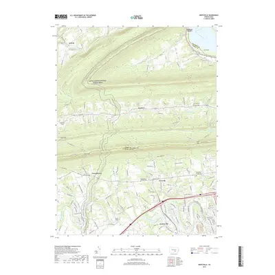
2019 Map of Wertzville
USGS Topo · Published 2019About this map
Conodoguinet Creek meanders across the southern landscape of this 2019 survey, defining a region where modern infrastructure meets historic rural patterns. The map highlights the transition between the rolling valley floor and the prominent ridges of the Blue Mountain, crossed by the Appalachian National Scenic Trail and the Tuscarora Trail. Significant topographic features like Millers Gap and Lambs Gap serve as traditional transit points through the high ground. Local history is anchored by family and community landmarks such as Hustons Mill and the Kauffman Farm Graveyard. Small settlements like Wertzville, Donnellytown, and Keystone are scattered throughout, while larger water features including the Susquehanna River and Marysville Reservoir mark the eastern and northern boundaries of the quadrangle.
Find a feature on this map
38 named features on this map. Tap any name to fly to it.
Don’t see what you’re looking for? This feature index may not catch every label — zoom into the map to look around manually.
Map Details
Editions of this 2019 Wertzville Map
This is the sole edition of this map. No revisions or reprints were ever made.
Other maps of this area

1892 · Harrisburg
USGS Topo · 1:62,500

1899 · Harrisburg
USGS Topo · 1:62,500

1904 · Carlisle
USGS Topo · 1:62,500

1906 · New Cumberland
USGS Topo · 1:62,500

1907 · New Bloomfield
USGS Topo · 1:62,500

1924 · Harrisburg
USGS Topo · 1:62,500

1943 · New Cumberland
USGS Topo · 1:62,500

1943 · Harrisburg
USGS Topo · 1:62,500

1943 · New Bloomfield
USGS Topo · 1:62,500

1943 · Carlisle
USGS Topo · 1:62,500
Featured Places
- Middlesex Township, PA
- Wheatfield Township, PA
- Carroll Township, PA
- Kinkora Heights, Penn Township
- Hustons Mill, Silver Spring Township