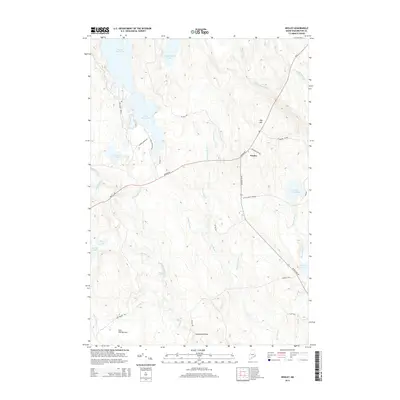
2014 Map of Wesley
USGS Topo · Published 2014About this map
The town of Wesley serves as a small interior hub within this landscape of glacial lakes and complex waterways in Washington County. Centered on the intersection of the Airline Rd and Jr Williams Rd, the map documents a region defined by its timber and recreation heritage. A dense network of logging roads, such as Champion 85-08-5 and Chain Lake Dam Rd, provides access to the surrounding wilds, connecting the scattered water bodies like First Chain Lake and Little Seavey Lake.
Find a feature on this map
41 named features on this map. Tap any name to fly to it.
Don’t see what you’re looking for? This feature index may not catch every label — zoom into the map to look around manually.
Map Details
Editions of this 2014 Wesley Map
This is the sole edition of this map. No revisions or reprints were ever made.
Other maps of this area

1941 · Wesley
USGS Topo · 1:62,500

1941 · Tug Mountain
USGS Topo · 1:62,500

1941 · Big Lake
USGS Topo · 1:62,500

1941 · Wabassus Lake
USGS Topo · 1:62,500

1943 · Big Lake
USGS Topo · 1:62,500

1943 · Tug Mountain
USGS Topo · 1:62,500

1943 · Wesley
USGS Topo · 1:62,500

1943 · Wabassus Lake
USGS Topo · 1:62,500

1952 · Big Lake
USGS Topo · 1:50,000

1953 · Wabassus Lake
USGS Topo · 1:62,500