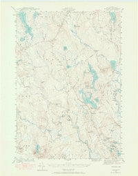
1941 Map of Wesley
USGS Topo · Published 1968About this map
Wesley and the surrounding unorganized townships of Washington County are defined by a complex network of glacial lakes and river systems as they appeared in 1941. The settlement of Wesley sits at the junction of the Old Beddington Road and modern highway routes, serving as a rare center of habitation alongside the Lower Wesley Sch. and Northfield Sch.. The landscape is a maze of water features with evocative names like Stinking Jam Rapids and Longfellow Pitch, suggesting a history of logging and river driving.
Find a feature on this map
105 named features on this map. Tap any name to fly to it.
Don’t see what you’re looking for? This feature index may not catch every label — zoom into the map to look around manually.
Map Details
Editions of this 1941 Wesley Map
3 editions found
Other maps of this area

1902 · Cherryfield
USGS Topo · 1:62,500

1904 · Cherryfield
USGS Topo · 1:62,500

1918 · Machias
USGS Topo · 1:62,500

1921 · Columbia Falls
USGS Topo · 1:62,500

1921 · Columbia Falls
USGS Topo · 1:62,500

1929 · Calais
USGS Topo · 1:48,000

1932 · Calais
USGS Topo · 1:62,500

1941 · Columbia Falls
USGS Topo · 1:62,500

1941 · Machias
USGS Topo · 1:62,500

1941 · Wesley
USGS Topo · 1:62,500