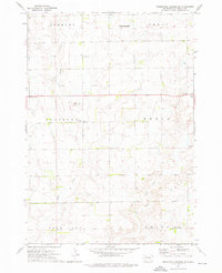
1973 Map of Wessington Springs SW
USGS Topo · Published 1976About this map
Smith Creek and its East Fork define the drainage of this Jerauld County landscape, where small rural institutions once anchored the townships of Harmony, Cherry, Pleasant, and Media. In the mid-1970s, the area remained a strictly agricultural landscape punctuated by essential community markers like Templeton Ch and several small country schools, including Pleasant View Sch, Schubert Sch, and Happy Hill Sch.
Find a feature on this map
18 named features on this map. Tap any name to fly to it.
Don’t see what you’re looking for? This feature index may not catch every label — zoom into the map to look around manually.
Map Details
Editions of this 1973 Wessington Springs SW Map
This is the sole edition of this map. No revisions or reprints were ever made.
Other maps of this area

1941 · Kimball North
USGS Topo · 1:62,500

1942 · Crow Lake
USGS Topo · 1:62,500

1951 · Kimball North
USGS Topo · 1:62,500

1953 · Huron
USGS Topo · 1:250,000

1954 · Huron
USGS Topo · 1:250,000

1955 · Mitchell
USGS Topo · 1:250,000

1959 · Mitchell
USGS Topo · 1:250,000

1973 · Wessington Springs NE
USGS Topo · 1:24,000

1973 · Cottonwood Lake
USGS Topo · 1:24,000

1973 · Wessington Springs
USGS Topo · 1:24,000