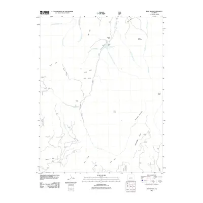
2011 Map of West Baldy
USGS Topo · Published 2011About this map
Indian Creek Bog Iron Mine and Hughes Mine signal the industrial legacy found within the Cochetopa Hills. This high-altitude drainage basin is defined by the convergence of Needle Creek and its various branches, including the Right Hand Needle Creek and Upper Left Hand Needle Creek. The local water management system is anchored by the Needle Creek Reservoir and its associated Needle Dam, situated near the prominent geological landmark of Needle Rock.
Find a feature on this map
33 named features on this map. Tap any name to fly to it.
Don’t see what you’re looking for? This feature index may not catch every label — zoom into the map to look around manually.
Map Details
Editions of this 2011 West Baldy Map
This is the sole edition of this map. No revisions or reprints were ever made.
Other maps of this area

1956 · Montrose
USGS Topo · 1:250,000

1959 · Montrose
USGS Topo · 1:250,000

1960 · Montrose
USGS Topo · 1:250,000

1962 · Doyleville
USGS Topo · 1:24,000

1962 · West Baldy
USGS Topo · 1:24,000

1962 · Houston Gulch
USGS Topo · 1:24,000

1962 · Razor Creek Dome
USGS Topo · 1:24,000

1964 · Sargents
USGS Topo · 1:24,000
1967 · North Pass
USGS Topo · 1:24,000

1967 · Sargents Mesa
USGS Topo · 1:24,000