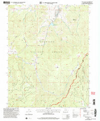
2001 Map of West Baldy
USGS Topo · Published 2005About this map
Gunnison National Forest and Rio Grande National Forest converge at the high ridgelines of Saguache County in this 2001 revision of a mid-century survey. The terrain is defined by dramatic peaks and deep gulches, including West Baldy and Middle Baldy, which overlook a complex network of drainage creeks such as Needle Creek and Razor Creek. This high-altitude landscape preserves evidence of both transient labor and more permanent markers of human presence, from the remote Shortys Cabin in the south to the Hughes Mine Grave near Hughes Mine in the central western portion of the sheet.
Find a feature on this map
40 named features on this map. Tap any name to fly to it.
Don’t see what you’re looking for? This feature index may not catch every label — zoom into the map to look around manually.
Map Details
Editions of this 2001 West Baldy Map
This is the sole edition of this map. No revisions or reprints were ever made.
Other maps of this area

1956 · Montrose
USGS Topo · 1:250,000

1959 · Montrose
USGS Topo · 1:250,000

1960 · Montrose
USGS Topo · 1:250,000

1962 · Doyleville
USGS Topo · 1:24,000

1962 · West Baldy
USGS Topo · 1:24,000

1962 · Houston Gulch
USGS Topo · 1:24,000

1962 · Razor Creek Dome
USGS Topo · 1:24,000

1964 · Sargents
USGS Topo · 1:24,000
1967 · North Pass
USGS Topo · 1:24,000

1967 · Sargents Mesa
USGS Topo · 1:24,000