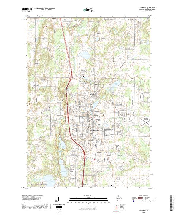
2022 Map of West Bend
USGS Topo · Published 2022About this map
The Milwaukee River carves a path through this landscape, anchoring the historic centers of West Bend, Barton, and Young America. The terrain is defined by the Kettle Moraine formations, creating a dense network of water bodies including Wallace Lake, Smith Lake, and Silver Lake. This 2022 survey captures the modern geography of the region, where educational and civic institutions like the University of Wisconsin - Washington County and the Washington County Justice Center stand alongside long-established landmarks. Genealogists can trace local history through numerous burial grounds, including Newark Cem, Old Saint Marys Cem, and Holy Angels Cem. The map also highlights the winding route of the Ice Age National Scenic Trl, which traverses the glacial topography alongside major transit corridors and the West Bend Municipal Airport.
Find a feature on this map
69 named features on this map. Tap any name to fly to it.
Don’t see what you’re looking for? This feature index may not catch every label — zoom into the map to look around manually.
Map Details
Editions of this 2022 West Bend Map
This is the sole edition of this map. No revisions or reprints were ever made.
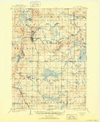
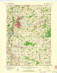
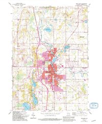
Historical Maps of Young America Through Time
4 maps found