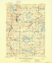
1904 Map of West Bend
USGS Topo · Published 1950About this map
The Milwaukee River meanders through the heart of Washington County, anchoring a landscape defined by turn-of-the-century industry and transport. At the center, the growing town of West Bend serves as a hub where the Chicago and Northwestern railroad meets the river's edge. To the north and west, glacial features such as Wallace Lake, Silver Lake, and Cedar Lake dot the terrain, providing a natural contrast to the grid-like organization of rural townships like Jackson and Farmington.
Find a feature on this map
46 named features on this map. Tap any name to fly to it.
Don’t see what you’re looking for? This feature index may not catch every label — zoom into the map to look around manually.
Map Details
Editions of this 1904 West Bend Map
3 editions found
Other maps of this area

1892 · Milwaukee
USGS Topo · 1:62,500

1892 · Waukesha
USGS Topo · 1:62,500

1892 · Oconomowoc
USGS Topo · 1:62,500

1892 · Port Washington
USGS Topo · 1:62,500

1901 · Milwaukee
USGS Topo · 1:62,500

1901 · Waukesha
USGS Topo · 1:62,500

1904 · West Bend
USGS Topo · 1:62,500

1904 · Port Washington
USGS Topo · 1:62,500

1904 · Hartford
USGS Topo · 1:62,500

1906 · Waukesha
USGS Topo · 1:62,500