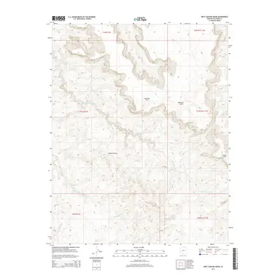
2014 Map of West Canyon Creek
USGS Topo · Published 2014About this map
Cummings Mesa dominates this high-desert landscape in Coconino County, characterized by the complex drainage systems of the Rainbow Plateau and the deeply incised waters of West Canyon Creek. The topography is defined by significant elevation changes, ranging from the submerged reaches of Lake Powell in the northwest to the prominent heights of Octagon Butte. The map details a labyrinth of geological formations including Wetherill Canyon and the expansive Sei Billikoon drainage area. This 2014 survey records the land as it appeared before more recent environmental shifts, providing an essential reference for understanding the hydraulic and geological patterns of this portion of northern Arizona. The absence of improved roads or settlements reflects the challenging nature of this terrain, where movement is dictated by the natural corridors of the canyons and mesa tops.
Find a feature on this map
13 named features on this map. Tap any name to fly to it.
Don’t see what you’re looking for? This feature index may not catch every label — zoom into the map to look around manually.
Map Details
Editions of this 2014 West Canyon Creek Map
This is the sole edition of this map. No revisions or reprints were ever made.
Other maps of this area

1883 · Marsh Pass
USGS Topo · 1:250,000

1886 · Escalante
USGS Topo · 1:250,000

1886 · Henry Mountains
USGS Topo · 1:250,000

1886 · Echo Cliffs
USGS Topo · 1:250,000

1891 · Echo Cliffs
USGS Topo · 1:250,000

1892 · Marsh Pass
USGS Topo · 1:250,000

1892 · Henry Mountains
USGS Topo · 1:250,000

1953 · Cummings Mesa
USGS Topo · 1:62,500

1953 · Navajo Mountain
USGS Topo · 1:62,500

1954 · Navajo Creek
USGS Topo · 1:62,500