
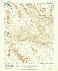
1954 Map of Navajo Creek
USGS Topo · Published 1956About this map
Navajo Indian Reservation lands dominate this mid-century survey, revealing a landscape where traditional life and deep-cut geology meet. Isolated dwellings such as Hogan are scattered across the high tablelands of the Rainbow Plateau and Weed Bench, far removed from established towns. The intricate drainage network of Navajo Creek and West Canyon Creek has carved the sandstone into distinct landforms like the Natural Bridge and the towering Tsa-i-Skizzi Rock.
Find a feature on this map
25 named features on this map. Tap any name to fly to it.
Don’t see what you’re looking for? This feature index may not catch every label — zoom into the map to look around manually.
Map Details
Editions of this 1954 Navajo Creek Map
3 editions found
Other maps of this area

1883 · Marsh Pass
USGS Topo · 1:250,000

1886 · Escalante
USGS Topo · 1:250,000

1886 · Henry Mountains
USGS Topo · 1:250,000

1886 · Echo Cliffs
USGS Topo · 1:250,000

1891 · Echo Cliffs
USGS Topo · 1:250,000

1892 · Marsh Pass
USGS Topo · 1:250,000

1892 · Henry Mountains
USGS Topo · 1:250,000

1922 · Warm Creek
USGS Topo · 1:63,360

1953 · Cummings Mesa
USGS Topo · 1:62,500

1953 · Navajo Mountain
USGS Topo · 1:62,500