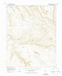
1954 Map of Navajo Creek
USGS Topo · Published 1975About this map
The Navajo Indian Reservation landscape is meticulously documented here during the mid-1950s, a period of transition as the region prepared for the creation of Lake Powell. This survey includes blue hatching to designate vast areas along Navajo Creek, Sand Wash, and West Canyon Creek that were identified to be submerged at an elevation of 3700 feet. This detail provides a valuable look at the original canyon floor topography before the inundation changed the geography forever.
Find a feature on this map
28 named features on this map. Tap any name to fly to it.
Don’t see what you’re looking for? This feature index may not catch every label — zoom into the map to look around manually.
Map Details
Editions of this 1954 Navajo Creek Map
3 editions found

Other maps of this area

1883 · Marsh Pass
USGS Topo · 1:250,000

1886 · Escalante
USGS Topo · 1:250,000

1886 · Henry Mountains
USGS Topo · 1:250,000

1886 · Echo Cliffs
USGS Topo · 1:250,000

1891 · Echo Cliffs
USGS Topo · 1:250,000

1892 · Marsh Pass
USGS Topo · 1:250,000

1892 · Henry Mountains
USGS Topo · 1:250,000

1922 · Warm Creek
USGS Topo · 1:63,360

1953 · Cummings Mesa
USGS Topo · 1:62,500

1953 · Navajo Mountain
USGS Topo · 1:62,500