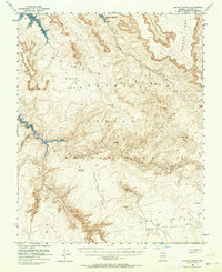
1954 Map of Navajo Creek
USGS Topo · Published 1964About this map
The Navajo Indian Reservation dominates this mid-century landscape, characterized by the dramatic elevation shifts between high plateaus and deep canyon systems. Blue hatching along the banks of Lake Powell indicates areas that were anticipated to be submerged as the water level rose toward the 3700-foot mark, a significant visual record of the changing hydrology in Coconino County. The survey identifies traditional Hogan structures and livestock-related infrastructure such as a Water Tank and several Reservoirs scattered across the Rainbow Plateau. Notable landmarks like the Natural Bridge and the distinct formation of Tsa Skizzi Rock provide fixed points for navigation across the Cedar Tree Bench and Weed Bench. Major drainages including Navajo Creek and Kaibito Creek define the erosion patterns of the Cummings Mesa, while an unimproved dirt road provides the only terrestrial link through the southern reaches near Gray Mountain.
Find a feature on this map
23 named features on this map. Tap any name to fly to it.
Don’t see what you’re looking for? This feature index may not catch every label — zoom into the map to look around manually.
Map Details
Editions of this 1954 Navajo Creek Map
3 editions found

Other maps of this area

1883 · Marsh Pass
USGS Topo · 1:250,000

1886 · Escalante
USGS Topo · 1:250,000

1886 · Henry Mountains
USGS Topo · 1:250,000

1886 · Echo Cliffs
USGS Topo · 1:250,000

1891 · Echo Cliffs
USGS Topo · 1:250,000

1892 · Marsh Pass
USGS Topo · 1:250,000

1892 · Henry Mountains
USGS Topo · 1:250,000

1922 · Warm Creek
USGS Topo · 1:63,360

1953 · Cummings Mesa
USGS Topo · 1:62,500

1953 · Navajo Mountain
USGS Topo · 1:62,500