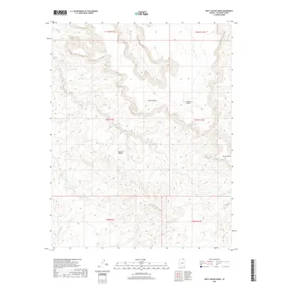
2018 Map of West Canyon Creek
USGS Topo · Published 2018About this map
Rainbow Plateau and the high elevations of Cummings Mesa define this high-desert landscape in northern Coconino County. The topography is dominated by dramatic drainages, including the deeply incised Wetherill Canyon and the winding course of W Canyon Creek. These landforms suggest a remote territory where movement is dictated by the steep verticality of the plateaus and the natural corridors carved by seasonal water flow. Distinctive landmarks like Octagon Butte serve as orientation points amidst a complex network of canyons and washes, such as Sei Bilihoan. This 2018 survey provides a modern snapshot of the protected backcountry, showing a landscape largely defined by its geologic features rather than human development.
Find a feature on this map
12 named features on this map. Tap any name to fly to it.
Don’t see what you’re looking for? This feature index may not catch every label — zoom into the map to look around manually.
Map Details
Editions of this 2018 West Canyon Creek Map
This is the sole edition of this map. No revisions or reprints were ever made.
Other maps of this area

1883 · Marsh Pass
USGS Topo · 1:250,000

1886 · Escalante
USGS Topo · 1:250,000

1886 · Henry Mountains
USGS Topo · 1:250,000

1886 · Echo Cliffs
USGS Topo · 1:250,000

1891 · Echo Cliffs
USGS Topo · 1:250,000

1892 · Marsh Pass
USGS Topo · 1:250,000

1892 · Henry Mountains
USGS Topo · 1:250,000

1953 · Cummings Mesa
USGS Topo · 1:62,500

1953 · Navajo Mountain
USGS Topo · 1:62,500

1954 · Navajo Creek
USGS Topo · 1:62,500