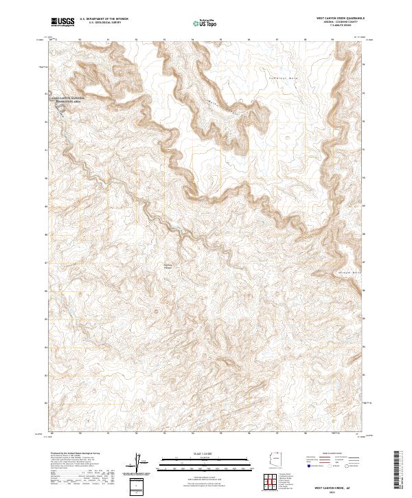
2021 Map of West Canyon Creek
USGS Topo · Published 2021About this map
Rainbow Plateau and Cummings Mesa define the high-relief landscape of this northern Arizona survey. The map details the complex drainage systems that carve through the Glen Canyon National Recreation Area, where West Canyon and W Canyon Cr intersect the layered topography. These natural features represent the traditional terrain of the Navajo Nation, providing a technical look at the geological formations like Octagon Butte and Wetherill Canyon as they stood in the early 21st century. The inclusion of remote water sources such as Sei Billikeen highlights the map's value for tracing seasonal water flow and navigation in a region defined by its verticality rather than human settlement.
Find a feature on this map
14 named features on this map. Tap any name to fly to it.
Don’t see what you’re looking for? This feature index may not catch every label — zoom into the map to look around manually.
Map Details
Editions of this 2021 West Canyon Creek Map
This is the sole edition of this map. No revisions or reprints were ever made.
Other maps of this area

1883 · Marsh Pass
USGS Topo · 1:250,000

1886 · Escalante
USGS Topo · 1:250,000

1886 · Henry Mountains
USGS Topo · 1:250,000

1886 · Echo Cliffs
USGS Topo · 1:250,000

1891 · Echo Cliffs
USGS Topo · 1:250,000

1892 · Marsh Pass
USGS Topo · 1:250,000

1892 · Henry Mountains
USGS Topo · 1:250,000

1953 · Cummings Mesa
USGS Topo · 1:62,500

1953 · Navajo Mountain
USGS Topo · 1:62,500

1954 · Navajo Creek
USGS Topo · 1:62,500