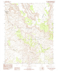
1985 Map of West Canyon Creek
USGS Topo · Published 1985About this map
The Navajo Indian Reservation covers the vast majority of this landscape, characterized by the dramatic elevation changes of the Rainbow Plateau. To the north, the high plateau of Cummings Mesa drops sharply into a network of drainage systems, including Wetherill Canyon and West Canyon Creek. The presence of a Pack Trail winding through the northern canyons and the distinctively named Nashdoi tii Ylyiisxtni peak reflect the traditional movement patterns and cultural geography of the area.
Find a feature on this map
12 named features on this map. Tap any name to fly to it.
Don’t see what you’re looking for? This feature index may not catch every label — zoom into the map to look around manually.
Map Details
Editions of this 1985 West Canyon Creek Map
This is the sole edition of this map. No revisions or reprints were ever made.
Other maps of this area

1883 · Marsh Pass
USGS Topo · 1:250,000

1886 · Escalante
USGS Topo · 1:250,000

1886 · Henry Mountains
USGS Topo · 1:250,000

1886 · Echo Cliffs
USGS Topo · 1:250,000

1891 · Echo Cliffs
USGS Topo · 1:250,000

1892 · Marsh Pass
USGS Topo · 1:250,000

1892 · Henry Mountains
USGS Topo · 1:250,000

1953 · Cummings Mesa
USGS Topo · 1:62,500

1953 · Navajo Mountain
USGS Topo · 1:62,500

1954 · Navajo Creek
USGS Topo · 1:62,500