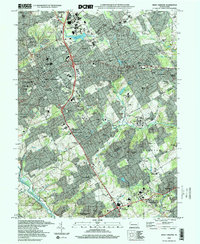
1997 Map of West Chester
USGS Topo · Published 2000About this map
West Chester serves as the central hub of this landscape, where the dense grid of the borough meets the rolling institutional grounds of West Chester University and the Brandywine Airport. The map documents a transition from the compact urban core to the surrounding townships of West Goshen and East Goshen, characterized by a mix of historic institutional sites and expanding residential developments like Woodcrest and Chatwood. To the south, the terrain becomes increasingly steeped in revolutionary history as it reaches the Brandywine Battlefield State Park. The survey captures the intricate water network of the East Branch Chester Creek and Brandywine Creek, while several prominent cemeteries, including the Birmingham Lafayette Cemetery and Old Log Friends Cem, provide significant markers for genealogical research. This late-century layout shows the area just as the Septa rail lines and arteries like the Wilmington Pike were solidifying the region's modern suburban character.
Find a feature on this map
134 named features on this map. Tap any name to fly to it.
Don’t see what you’re looking for? This feature index may not catch every label — zoom into the map to look around manually.
Map Details
Editions of this 1997 West Chester Map
This is the sole edition of this map. No revisions or reprints were ever made.
Other maps of this area

1894 · Chester
USGS Topo · 1:62,500

1894 · Norristown
USGS Topo · 1:62,500

1895 · Norristown
USGS Topo · 1:62,500

1896 · Norristown
USGS Topo · 1:62,500

1896 · Chester
USGS Topo · 1:62,500

1898 · Chester
USGS Topo · 1:62,500

1901 · Camden
USGS Topo · 1:125,000

1901 · West Chester
USGS Topo · 1:62,500

1904 · West Chester
USGS Topo · 1:62,500

1906 · Phoenixville
USGS Topo · 1:62,500
Featured Places
- West Goshen Township, PA
- West Chester, PA
- Willistown Township, PA
- Westtown, Thornbury Township
- Birmingham Township, PA