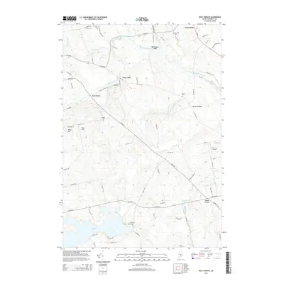
2014 Map of West Corinth
USGS Topo · Published 2014About this map
Kenduskeag Stream and its numerous tributaries, including Crooked Brook and French Stream, define the drainage of this Penobscot County landscape. The mapping of McGregor Mill and the clustered settlement at Exeter Mills reflects a local economy historically tied to these watercourses. This 2014 survey reveals a high density of burial sites across the township, such as Osgood Cem, No Exeter Cem, and Boutell Cem, which provide significant anchor points for genealogical research. The road network connects small rural hubs like East Exeter and West Corinth, while the southern portion of the quadrangle is dominated by the expanse of Pleasant Lake. Significant terrain features like Eaton Hill and Bragg Hill rise above the stream valleys, and the presence of the Terra B & B Airport near West Levant indicates modern utility alongside these older agricultural and industrial foundations.
Find a feature on this map
82 named features on this map. Tap any name to fly to it.
Don’t see what you’re looking for? This feature index may not catch every label — zoom into the map to look around manually.
Map Details
Editions of this 2014 West Corinth Map
This is the sole edition of this map. No revisions or reprints were ever made.
Other maps of this area

1902 · Bangor
USGS Topo · 1:62,500

1931 · Stetson
USGS Topo · 1:48,000

1932 · Dover-Foxcroft
USGS Topo · 1:48,000

1933 · Boyd Lake
USGS Topo · 1:62,500

1935 · Dover-Foxcroft
USGS Topo · 1:62,500

1935 · Stetson
USGS Topo · 1:62,500

1942 · Bangor
USGS Topo · 1:62,500

1946 · Bangor
USGS Topo · 1:62,500

1948 · Bangor
USGS Topo · 1:250,000

1951 · Boyd Lake
USGS Topo · 1:50,000