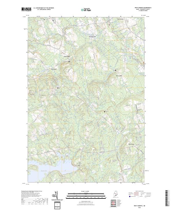
2024 Map of West Corinth
USGS Topo · Published 2024About this map
The agricultural and wooded hills of Penobscot County are defined by a network of streams and mill-related settlements in this modern survey. East Corinth and West Corinth anchor the eastern side of the quadrangle, while Exeter Mills and McGregor Mill highlight the historical importance of water power along Kenduskeag Stream and French Stream. The landscape is dotted with several family-named burial grounds, such as Vickery Cem and Boutell Cem, which provide essential points of reference for genealogical research in this part of Maine.
Find a feature on this map
83 named features on this map. Tap any name to fly to it.
Don’t see what you’re looking for? This feature index may not catch every label — zoom into the map to look around manually.
Map Details
Editions of this 2024 West Corinth Map
This is the sole edition of this map. No revisions or reprints were ever made.
Other maps of this area

1902 · Bangor
USGS Topo · 1:62,500

1931 · Stetson
USGS Topo · 1:48,000

1932 · Dover-Foxcroft
USGS Topo · 1:48,000

1933 · Boyd Lake
USGS Topo · 1:62,500

1935 · Dover-Foxcroft
USGS Topo · 1:62,500

1935 · Stetson
USGS Topo · 1:62,500

1942 · Bangor
USGS Topo · 1:62,500

1946 · Bangor
USGS Topo · 1:62,500

1948 · Bangor
USGS Topo · 1:250,000

1951 · Boyd Lake
USGS Topo · 1:50,000